
Orthomosaic Mapping
Capture massive multi-hundred-acre properties with precision, detail, and accuracy. We leverage advanced software to stitch together thousands of drone photos to produce high quality orthomosaic maps. See fine details with up to 0.7 in/px resolution.
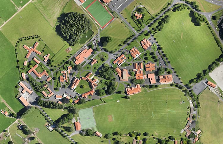
Orthomosaic Mapping
Capture massive properties with precision, detail, and accuracy.
We use advanced software to stitch together thousands of drone photos to produce high quality orthomosaic maps.
See fine details with up to a couple millimeters of accuracy!
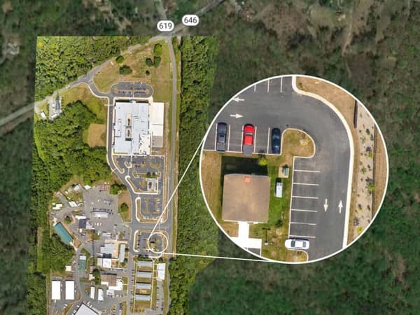
We deliver ALL the original photos used to stitch your map and deliver the following output formats:
Georeferenced Imagery Raster files that are compatible with most common GIS softwares
- GeoTIFF High quality image at up to 300k x 300k.
- DEM (DSM) GeoTIFF High quality image at 1/4 of GeoTIFF resolution. 32-bit elevations with NODATA.
- Colorized DEM GeoTIFF High quality image at 1/4 of GeoTIFF resolution.
- NDVI GeoTIFF High quality image at 1/2 of GeoTIFF resolution. Customizable color mapping. Red or Blue filtered input images.
Standard Imagery Image files that are suitable for printing or manual GIS work
- Tiff High quality image at up to 300k x 300k.
- JPG Compressed image at up to 300k x 300k.
- Colorized DEM JPG Compressed image at 1/4 of GeoTIFF resolution.
- NDVI JPG Compressed image at 1/2 of GeoTIFF resolution.
- PRICING: $300 up to 30 acres, $400 up to 50 acres, call or email for larger areas